Broom
BroomVillage Hall car park – survey results
A consultation was undertaken to assist in the future management of the car park at Broomfield Village Hall, which is owned by the Village Hall Charity.
For results see here Survey results
A consultation was undertaken to assist in the future management of the car park at Broomfield Village Hall, which is owned by the Village Hall Charity.
For results see here Survey results
For the latest news on the Kings Arms Public House , see the following press release by the letting agents, Sidney Phillips –
Leisure and hospitality specialist Sidney Phillips has successfully let the Kings Arms in Broomfield.
The Kings Arms is a substantial Grade II listed public house, dominating a notable roadside position on one of Chelmsford’s busiest arterial roads. It comprises a two-section bar, five bedroom accommodation, trade patio and car park, a blank canvass waiting to be refurbished and relaunched.
Despite the property has been vacant for a number of years, Sidney Phillips generated large amounts of interest from parties interested in acquiring both the freehold and leasehold interests.
Sidney Phillips has now brokered and completed the grant of a new free-of-tie lease to a regional multi-site operator, who intends to extensively refurbish the 17th Century property to create an appealing pub with boutique letting bedrooms.
Following reports of workmen in the pub and possible building works, see the following response from Chelmsford City Council Planning Enforcement Team –
Planning Enforcement Case 23/00329/ENFA – The Kings Arms, Main Road, Broomfield, CM1 7AU
I am writing to let you know the outcome of our investigations into the possible breach of planning control at the above address which you reported to us one week ago. This was concerning works to the listed building.
A site visit has been conducted and no evidence was found to suggest that any building/renovation works have occurred. The building appeared to be vacant at the time of the visit.
With this in mind, no breach of planning control has been found and the case will be closed.
The enforcement team have written to the tenant to remind them of the requirement to obtain the relevant consents prior to carrying out any works.
Please note that the opinions given are at officer level only and are without prejudice to any formal determination the Council may ultimately take in respect of this matter.
Broomfield Parish Council Chairman, Margaret Bleet, said
“We have applied for the pub to be an asset of community value. This will still go ahead. That means that if the pub is put up for sale again within three years we get an opportunity to buy it. We wish the new owners every success and hope that you will all be using it.”
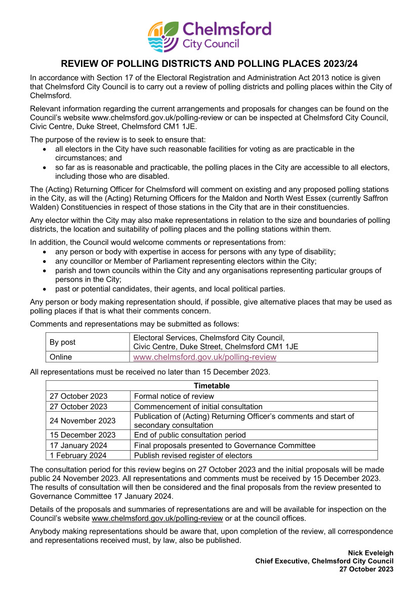
Chelmsford City Council are undertaking a review of the Polling Stations that are provided for the various district wide elections that are held. The notice below explains how you can make your views known….
As a result of a competition for students of Chelmer Valley High School to produce a new village sign, the winning entrant, Alexandra Bennion, has had her design installed on Angel Green. An official ‘unveiling’ of the sign will take place on Thursday 16th November at 3.30pm in the presence of the deputy Mayor of Chelmsford.

Thanks to all the residents who came to the Broomfield Planning Committee on 4th October. Councillors were really pleased to see so many people and are very grateful for your interest and support in planning issues.
For information, please see the Parish Council’s response to:
As you’ll recall, councillors unanimously decided to object to both applications and recommend refusal to the City Council (which makes the actual decision). Due to considerable local interest in these two planning applications considered at the recent Planning Committee meeting of 4th October, it was agreed that the comments made by the Parish Council would be published on the website (In addition to within the minutes of the Planning Committee as normal). As promised the comments are shown below –
Roselawn Farm –
BROOMFIELD PARISH COUNCIL
COMMENTS ON PLANNING APPLICATION 23/01487/FUL
Retrospective Application for change of use of land to Showmen’s Permanent Quarters
Broomfield Parish Council (‘the Council’) welcomes the opportunity to comment on this application. It has caused significant concern for residents, due to the sudden implementation of the development prior to any planning consent, as well as to the principle of development in a protected area. However, the Council’s objections below focus directly on planning considerations rather than the understandable feelings of concern within the local community.
The development site lies well within the designated Green Wedge where Strategic Policy S11, part B, states that:
‘Development which materially harms the role, function and intrinsic character and beauty of the Green Wedge will not be approved.’
The application points out by reference to a number of landscape assessments that this southern section of the Chelmer Valley Green Wedge does not have the same quality of landscape as other parts of the Green Wedge to the north. It also notes that the site is on land that has not been professionally judged to be a ‘Valued Landscape’ in the Broomfield Neighbourhood Plan (NP) evidence base. However, this is to miss the point that the Green Wedge is a ‘multi-faceted’ landscape, serving a number of purposes and functions. It is not simply about ‘intrinsic beauty’. Chief amongst its functions is the prevention of ‘urban sprawl and settlement coalescence’; as well as opportunities for ‘leisure and recreation and travel by cycling and walking’ (see section 5 below for the latter).
In this section of the Green Wedge, the buildings of Roselawn Farm already present a prominent salient of settlement area into the Green Wedge. The proposed site would be a further significant intrusion into the central part of the Green Wedge between the Ambulance Station and Springfield to the east; and the Vellacotts/Ashford Place area of Broomfield to the west. The degree of separation between settlement areas is already fairly narrow and, as the LVA accompanying the application points out, the functions of the Green Wedge are already rather jeopardized here by a number of urbanizing influences, such as a phone masts, fences, farm buildings, perimeter walls and security paraphernalia associated with Roselawn Farm.
By penetrating further into the central part of the Green Wedge, the proposed development would therefore significantly increase the degree of ‘urban sprawl and settlement coalescence’, directly contrary to Policy S11b of the adopted Local Plan. If such a development were approved, there would be no grounds to refuse applications in more peripheral areas of the Green Wedge, such as (in Broomfield) at Campions Farm, further undermining the purpose of the strategic policy. The application therefore cannot be supported, on the basis of its impact on the Green Wedge alone.
The application is accompanied by a Landscape and Visual Appraisal (LVA). This document makes clear it is not a Landscape and Visual Impact Assessment (LVIA) so ‘does not assess the significance of the impacts’ (para. 1.3).
The application makes reference inter alia to the Broomfield NP Landscape Appraisal, in particular to the professional judgement that ‘the nature of valley topography and gentle knowle of higher land south of Roselawn Farm presents some opportunity for a carefully thought through extension of the urban edge’ in the general area. However, the application is rather confused about the exact geography of the area. The proposed development site lies not on the edge of the settlement , but to the south-east of the ‘gentle knowle’, The NP Landscape Appraisal makes clear that any ‘development should be set back behind (i.e. to the west of) the slight knowle or rise in land south of Roselawn Farm …’. Further, the NP Appraisal states that any development must ensure that ‘from the elevated knowle opportunities for viewing the wider valley are embraced’. The proposed development would be directly at the forefront of these wider valley views when seen from the ‘gentle knowle.’ The application therefore does not conform with the NP Landscape Appraisal.
The LVA refers to the amount of screening provided by vegetation around the proposed site and that this could be enhanced by new hedgerow planting. However, this seems to relate mainly to the low-level dwellings themselves, whereas Policy DM3 of the adopted Local Plan makes rightly states that new plots for travelling showpeople must ‘enable the storage, repair and maintenance of equipment.’
Indeed, the Design and Access Statement, para. 2.2.3, specifically states that ‘increases in the size of vehicles and rides’ and the consequent need to store them over several sites is one of the reasons why new accommodation is sought. This is rather at odds with the assertion in the LVA that ‘HGVs and fairground equipment at the site … are single storey and small scale’ (Para 4.39).
Clearly the visual impact of equipment and vehicles is important and could be greater than the impact of the dwellings themselves. Para 4.46 of the LVA acknowledges this, but makes only passing reference, suggesting that ‘with a backdrop of the commercial area the changes due to the Proposals will be limited.’ This is hardly a ringing endorsement of the proposals and, in any event, the commercial area will only provide a backdrop when the site is viewed from the south.
Finally, the LVA also seems confused in its assertion that for most of the year ‘there will be no homes upon the site’ (also para 4.39). Para. 5.3 of the Design and Access Statement makes clear accommodation on the plots will include ‘residential chalets’ – indeed, local residents reported seeing these being transported on to the site in September. These inconsistencies all give the impression that the LVA has only a limited grasp of what is actually being proposed/already on site; and that consequently its reassuring conclusions are of limited value.
Broomfield sits astride the B1008, which is classed as a Principal Route One (PR1) – a major route into Chelmsford City Centre from the north. It also forms the only road access to Broomfield Hospital, the City’s general hospital and largest employer. The B1008 is therefore a key route for emergency vehicles.
The result is extreme congestion at peak times. The B1008 is at 96% capacity, one of the most congested routes in Chelmsford. This is evidenced in a range of professional studies, for instance:
Furthermore, pressure on the B1008 Main Road will increase during the next few years due to the construction of the growth site ‘north of Broomfield’ (512 dwellings) which has been allocated in the Local Plan.
It is therefore critical that any new development mitigates its impact on the B1008. Potential traffic mitigation measures are outlined in the Broomfield NP (in section 12 of the NP and in: https://www.broomfieldnp.org.uk/_UserFiles/Files/Evidence%20and%20Documents/maps%20of%20suggested%20traffic%20improvements.pdf ). In the case of a development on the eastern side of the village, relevant measures could include funding a signalized junction at the junction of Main Road, Ashford Place and Erick Avenue; and the provision of a right of access across land in the Chelmer Valley to support a new cycle and foot path from Valley Bridge to Mill Lane. This right of access is almost complete, as 5 of the 6 landowners in the Chelmer Valley (between Valley Bridge and Mill Lane) are willing in principle.
The Council notes there are no measures proposed in the application to mitigate traffic impact on the B1008. The expected increase of 92 two-way vehicle movements per day compared to the current 160 generated by all uses at Roselawn Farm represents a sizeable increase of 58%. This would mainly take effect during winter months when general traffic flows are likely to be heavier and conditions worse due to winter weather.
Given the existing pressures outlined above, there is no scope for even modest increases to be generated by a development without appropriate mitigation.
Currently, access to Roselawn Farm is via Saxon Way and an agricultural track across the field to the east. Both are unmade and belong to several different landowners. Several new properties face on to Saxon Way, though their vehicular access is from behind, from Ashford Place.
In the Council’s opinion, the current access is completely unsatisfactory even for current usage. Any new development accessed from Saxon Way would need to positively address this problem rather than simply adding pressure to the existing unsatisfactory arrangement.
In particular, residents have drawn the Council’s attention to the impact of heavy lorries using the current access, creating a lot of dust in dry weather. It seems likely that use by heavy lorries would increase if the application were approved, albeit at particular times of the year, making these problems worse. This would undermine the proper and healthy enjoyment of their residential amenity, so would be contrary to Policy DM3, A, vii. of the Local Plan. Further, it should be noted that there is a weight restriction on Main Road, which suggests that it is not considered generally suitable for heavy vehicles.
The Council therefore cannot support the application on traffic and access grounds, as well as those already outlined above.
The application notes that the Broomfield NP is currently ‘emerging’ and has not yet been independently examined, so its policies are not yet a material consideration. Nonetheless, Policy BFD4 is cited to support the development with regard to the proposed additional planting around the site. However, this policy is a requirement for new developments in general rather than a justification for any particular development proposal.
Further, the Council notes that the proposals are completely contrary to Policy BFD6 of the emerging NP. This policy seeks to support the role of the Green Wedge in furthering ‘leisure and recreation, and travel by cycling and walking (and)… good public access’ (LP Policy S11B). Community Action CA14 also outlines a strategy for encouraging a cycle and foot path network, including through the Chelmer Valley. It is an important consideration in a section of the Green Wedge where there is currently no such opportunity for leisure, public access etc. However, in contrast, the application seems to conclude that because there is no public access, there is no amenity to be lost. This completely misses the point of policy BFD6 and CA14 and therefore the emerging NP cannot be used to support the current application.
The development site is adjacent to the field at the eastern end of Saxon Way where an Anglo-Saxon princely burial was discovered during gravel extraction in the 1880s. It is a nationally significant site.
During further gravel excavation in the 1980s, a watching brief was maintained which found some evidence of Saxon occupation in the eastern part of the field (closest to the development site). It is assumed that there was a settlement linked to the burial, though its location is still unknown.
The application states that no archaeology was discovered during the digging of a pipeline across the development site in 2005. However, that was only a linear feature and not a substitute for a thorough archaeological appraisal. Given its proximity to such a significant site, an appraisal and written scheme of investigation if necessary should have been presented with the application.
Broomfield Primary School has recently been expanded to meet a shortfall in local places and to contribute to meeting the demand arising from the ‘north of Broomfield’ strategic site. Despite this expansion, the Council understands that the School continues to be oversubscribed and is full in most year groups.
It is important that all children in the local community can attend their local school if their parents wish. There is no evidence in the application to quantify the likely numbers of primary and secondary school children and whether the need for places can be met.
Section 2 of the Design and Access Statement outlines underprovision of plots for Travelling Showpeople in Thurrock, stating a need for about 200 additional plots by 2033. Paragraphs 5.14 and 5.15 then seek to link the obligation to provide additional places in Thurrock to this proposed site in Broomfield, citing the duty of planning authorities to co-operate where necessary on strategic planning issues.
Paragraph 5.15 speculates that Thurrock may struggle to meet its identified need in this regard due to the large proportion of Metropolitan Green Belt land (a similar argument could also be made for Chelmsford). However, no hard evidence is presented to show that Thurrock cannot not meet its identified need.
For the duty to co-operate to come into play, Thurrock Council would need to present a robust case to neighbouring authorities explaining why it was unable to meet its identified need. We understand from Chelmsford City Council that no such case has been presented, let alone agreed. Chelmsford has allocated sufficient sites to meet its own identified need (and will continue to do so) but has no obligation to provide plots on behalf of other authorities. Indeed, para 8.21 of the Chelmsford Local Plan states that the sites in the Green Wedge would not be considered appropriate, even in the context of meeting its own need.
Therefore, the suggested link between a shortfall in Thurrock and this particular application in Chelmsford does not exist – except in the very general sense that any resident of Thurrock may for their own reasons wish to relocate to another council area (which is not the same thing as a planning obligation).
As set out above, the Parish Council cannot see any compelling planning reasons for allowing the proposed development to go ahead, particularly given its proposed location well within the Green Wedge, nor any proposed mitigation of its likely main effects. The Council therefore requests that the application is refused.
We’ve heard that the temporary High Court injunction forbidding further development of the site at Roselawn Farm has been extended until the New Year while the application is decided. The City Council will continue to monitor this. We’ll keep you posted when we hear more.
Once again, thanks to everyone who came to our Planning Meeting to share their views on these applications. Councillors are constantly striving to ‘protect the best and enhance the rest’ in our wonderful village. We couldn’t do it without your help and support.
BROOMFIELD PARISH COUNCIL
COMMENTS ON PLANNING APPLICATION 23/01135/FUL
Proposed extension to petrol station to provide fast food takeaway
Broomfield Parish Council (‘the Council’) welcomes the opportunity to comment on this application. The application has created a lot of concern in the local community, with around 30 residents attending the Planning Committee meeting for this item.
In general, the Council welcomes new retail outlets and other facilities, though in this case there are already food outlets located close by. More importantly, there are a number of overriding planning issues which mean that the Council cannot support the application and therefore objects.
The Council’s key concern relates to traffic and access. Broomfield sits astride the B1008, which is classed as a Principal Route One (PR1) – a major route into Chelmsford City Centre from the north. It also forms the only road access to Broomfield Hospital, the City’s general hospital and largest employer. The B1008 is therefore a key route for emergency vehicles.
The result is extreme congestion at peak times. The B1008 is at 96% capacity, one of the most congested routes in Chelmsford. This is evidenced in a range of professional studies, for instance:
Furthermore, pressure on the B1008 Main Road will increase during the next few years due to the construction of the growth site ‘north of Broomfield’ (512 dwellings) which has been allocated in the Local Plan. It is therefore critical that any new development mitigates its impact on the B1008.
The proposed development is located near a complicated section of Main Road. Erick Avenue and Ashford Place/Saxon Way effectively form a crossroads with Main Road. Ashford Place is a relatively new development, with no highways mitigation (a concern which the Council raised at the time). Added to this is the access to the existing filling station and small shop, causing queues to form at some busy times. To the immediate north is a zebra crossing, where a serious accident occurred a few years ago. To the immediate south is the Co-Op store which has no off-road parking. Customers park on Main Road and delivery lorries frequently have to stop in the middle of the Road to unload, as parked vehicles prevent them from pulling in. On top of all this, most houses have drives or parking areas at the front that have access onto Main Road.
The Council’s concerns are therefore that:
Potential traffic mitigation measures are outlined in the Broomfield NP (in section 12 of the NP and in: https://www.broomfieldnp.org.uk/_UserFiles/Files/Evidence%20and%20Documents/maps%20of%20suggested%20traffic%20improvements.pdf ). In the case of a development on this eastern side of the village, relevant measures could include funding a signalized junction at the junction of Main Road, Ashford Place and Erick Avenue.
The Council notes there no measures are proposed in the application to mitigate traffic impact on the B1008. Given the existing pressures outlined above, there is no scope for even modest increases to be generated by a development without appropriate mitigation.
Whilst the proposed building is located at the north end of the site, further away from properties to the south and east, it is very close to properties to the north in Ashford Place/Saxon Way.
More importantly, the parking spaces are located at the eastern and southern edges of the site, meaning that noise, as well as light pollution during hours of darkness, will directly affect properties in Main Road and Vellacotts. The application suggests that permission is sought for a 24/7 facility, so vehicle headlights will be an issue for most hours of operation. However, even with more restricted hours of operation, the facility would have unacceptable effects on neighbours, particularly during hours of darkness.
This is partly due to the relative elevation of the site. Adjoining properties in Vellacotts and Main Road sit below the forecourt level, meaning that car headlights would be shining into first floor sleeping areas as vehicles manoeuvre in and out of the parking spaces situated around the edge of the site.
All this is contrary to Broomfield Village Design Statement (VDS) which has been adopted by the City Council as Supplementary Planning Guidance (SPG). The general, village-wide guidance includes that:
‘Measures to minimize light and noise pollution and other environmental degradation should feature in any new build ..’ (Section 6a, page 13)
The layout of the site would therefore need to completely re-designed and avoid these problems. The Council suspects that even with careful design this may be impossible.
Finally, neighbouring residents have reported significant issues with hygiene and rubbish – poor provision for refuse and inadequate recycling – and a lack of responsiveness when problems have been reported to the existing management. This does not inspire any confidence that an expanded site could cope effectively with these issues.
As well as the location of parking spaces outlined above, the application seems to propose poor use of the whole site, with the Greggs section simply bolted on without regard to any potential synergy with the existing forecourt or forecourt building. Currently, vehicles are able to park along the eastern boundary of the forecourt, but this would seem to be impossible with the proposed layout which pushes all parking to the edge of the site.
The Council also questions why so many parking spaces are required for a fast-food facility, as presumably visits would be very short. Also, in terms of synergy with the filling station, it would surely make sense for some parking spaces to offer electric charging facilities.
As indicated above, the Broomfield Village Design Statement (VDS) has been adopted by the City Council as Supplementary Planning Guidance (SPG). The general guidance in Section 6a includes the need for new buildings to harmonise with surrounding buildings. In this case, the building is clearly detached and set back from the existing forecourt building, so the vernacular style of the adjacent housing in Ashford Place is an important and positive consideration.
The VDS also states:
‘Exterior walls of new buildings should be constructed from traditional materials wherever possible’ (Section 6a, page 13)
The design of the proposed building appears to be ‘bog standard’ and functional, with a flat roof (also discouraged by the VDS). The Council appreciates that Greggs may prefer an element of common branding with its existing outlets, but this can be achieved whilst still respecting the building’s surroundings and the local environment. Of course, this is what the VDS aims to achieve for new development in the Parish. Currently, the design does not conform to this important SPG document.
Similarly, the application does not conform to general requirement in the VDS that:
‘Sympathetic landscaping needs to feature in new build, e.g. trees, shrubs and verges’ (Section 6a, page 13);
nor with the area specific guidance for this section of the village, which repeats that:
‘Trees, shrubs and green areas to be included into any new build.’ (Section 6b, page 23)
Currently, the site provides an unofficial wild green area. Even in a small site, it is important that this green character is retained through careful replacement landscaping and planting and not simply lost to concrete surfacing. Well-designed and effective planting could also help to avoid adverse impacts on neighbouring properties.
For the reasons set out above, the Parish Council requests that the application is refused.
October 2023.

The VILLAGE HALL is conveniently located on Main Road, set behind the Angel Public House in Broomfield.
To check for hall availability or to enquire about the cost to rent the hall(s) – see the website address below.
View Village Hall